 How An Ex-Mod Projection Can Help Control Work Comp Costs
Wildfire mapping is emerging as an important tool in the effort to understand and control wildfire risk. However, property owners have expressed concern over how these maps could impact their insurance policies and rates.
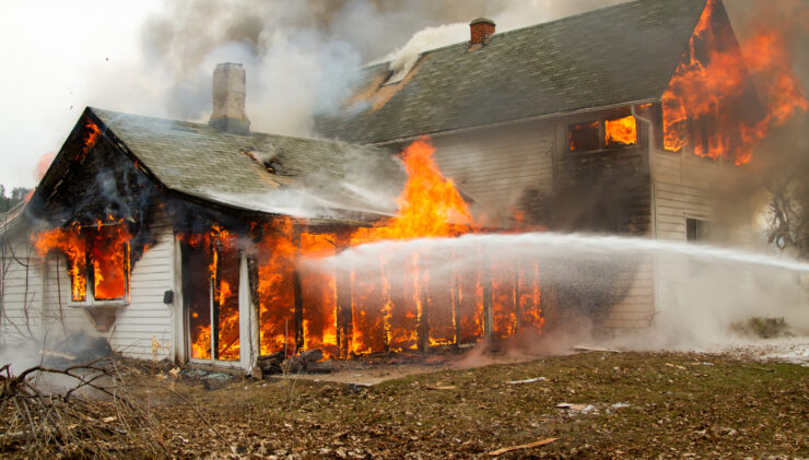
Wildfire Losses Mount
Large wildfires have caused severe losses in recent years. According to the Congressional Research Service, the number of annual wildfires has decreased slightly over the last 30 years, but the number of acres burned has increased. Since 2000, 7 million acres have burned each year on average, whereas only 3.3 million acres burned each year on average during the 1990s.
The problem is especially severe in the Western states. According to data from the National Interagency Fire Center, California had by far the highest number of acres burned in 2021 – with a total of 2,233,666 acres burned. Oregon came in at number two, followed by Montana, Washington, Arizona, and Idaho.
These wildfires have caused tremendous losses for both property owners and insurance companies. According to Scientific American, 2020 was a record-setting year for hurricanes and wildfires and insurers have been struggling to forecast risks in the face of climate change. This is a serious problem because insurance underwriting requires an accurate understanding of risk.
New Wildfire Mapping Techniques
As wildfires become more common, old risk models become less accurate. Enter new wildfire mapping techniques.
Government agencies, scientific researchers, and insurance carriers are investing in better wildfire risk mapping and modeling. For example, researchers at the University of Nevada, Reno, are using new technologies powered by “massive amounts of data and computational power” to assess risk in fire-prone parts of California. The research aims to produce maps to identify where the risk is greatest as well as modeling to determine how management strategies could help mitigate risk.
The Impact on Property Owners
Better wildfire mapping certainly seems like a good idea: the information could help policymakers develop better risk management strategies, which could enable communities to take control of their risk.
However, some property owners see a potential downside. If the new maps reveal greater risk, property owners worry their insurance rates will increase and they may have a harder time securing coverage.
According to the Pew Charitable Trusts, after the Oregon Department of Forestry released new wildfire maps, some property owners in Oregon received notices that they had a high or extreme fire risk and that they might be subject to new building and landscaping rules. Thousands of people complained, citing inaccuracies or expressing confusion.
Many people were worried about their insurance coverage. According to Oregon Capital Chronical, state financial regulators have said insurers do not plan to use the maps for underwriting and insurance rates will not increase because of the maps. However, at least one policyholder said his insurance company had decided not to renew a 20-year-old policy, citing the fact that the map identified his property as being high risk.
State Maps vs. Insurance Carrier Tools
Despite some policyholder claims to the contrary, Oregon officials insist that insurers are not using the new state maps for underwriting purposes. However, as wildfire risks have increased, insurance companies have responded by raising rates and sometimes deciding not to renew coverage. They’ve also developed their own tools to assess risk more accurately.
“We believe there has been confusion between decisions based on insurers’ continued use of their own tools, including their own risk maps, and the discussions on the new state wildfire risk map,” says Oregon Insurance Commissioner Andrew Stolfi.
The Insurance Industry Is Demanding Better Risk Modeling
Insurers are hungry for better risk modeling. They want information on both short-term and long-term risks, including how climate change is impacting these risks. They also want more detailed information on the level of risk in specific areas. Better risk modeling can provide this.
According to Risk & Insurance, AIR Worldwide recently made changes to its U.S. wildfire and hurricane models to provide insurers and their clients with better risk assessments.
What Property Owners Can Do
As wildfire risks increase, some policyholders are likely to see changes to their coverage. This can put property owners in a difficult position – they’re worried about both the risk of fire and their insurance coverage. However, property owners can be proactive.
- Use publicly available wildfire mapping to determine your risk.
- Consider wildfire risk when purchasing a new property.
- If your property is at risk, take steps to fire harden your home – FEMA has tips on how to do this.
- Work with an insurance agent to secure coverage for your home. If you receive a notice of non-renewal, talk to your agent to determine your options.
Are you worried about how the increase wildfire risk and wildfire mapping will impact your coverage? Reach out to Heffernan.